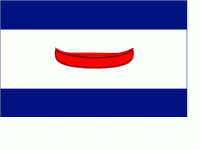
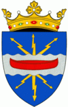
The Dubăsari District is a district in the east of Moldova, with the administrative center at Cocieri. As of January 1, 2011, its population was 35,200. This does not include the 715 people that live in the village of Roghi, which is controlled by the breakaway Tiraspol authorities. Dubăsari means ferry-arks (see coat of arms).
The territory which today is part of Dubăsari district has been inhabited since the Stone Age (50–30000 years BC). Location of the earliest documentary attestation of the district is Corjova, first attested in 1362. Other town with old certificate is Holercani village certified in 1464. This region is part of the Grand Duchy of Lithuania during 1386–1434. In 1393-1812 the part of district, situated on the right, of the Nistru is part of the Principality of Moldova. In this period to develop the economy (trade, agriculture), as population increases. In 1790, the part of district, situated on the left of Nistru is occupied by the Russian Empire had the same fate of Basarabia in 1812. In 1918, after the collapse of the Russian Empire, Basarabia united with Romania, but the part of district on the left of Nistru, is part of the Moldavian ASSR, part of Ukrainian SSR. In 1940 after the Molotov-Ribbentrop Treaty, Basarabia is occupied by the USSR. In 1991 as a result of the proclamation of Independence of Moldova, district is part of Moldova. In 1992, the district is the focus, the Moldovan-Russian War of Transnistria. Following the war, the district is divided into two: one controlled by the Republic of Moldova and the separatist-controlled part of the authorities in Tiraspol, which includes Dubăsari. District is part of the Chişinău County (1991-2003), and in 2003 became administrative unit of Moldova.